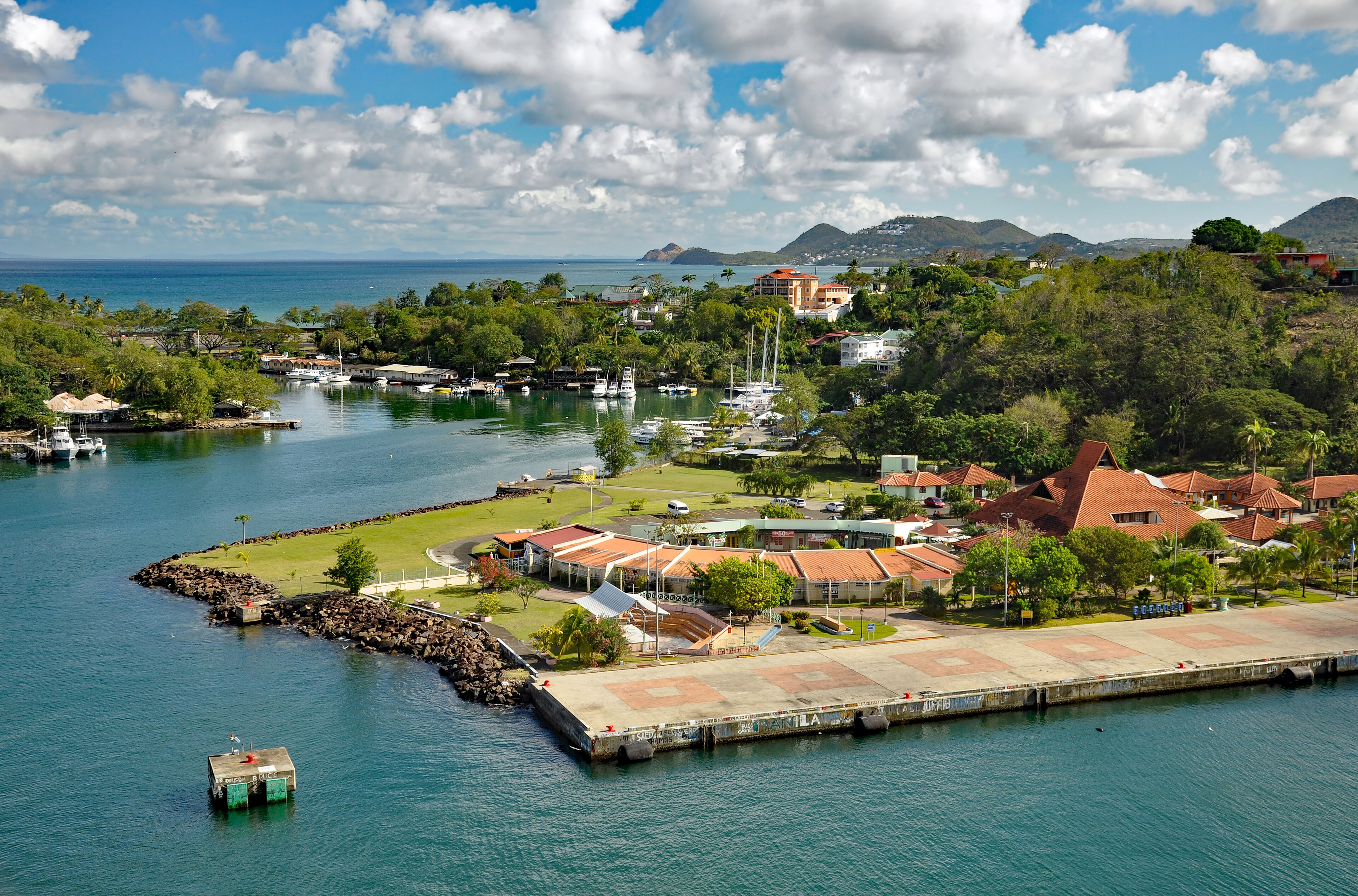
About Saint Lucia
Districts and Towns of Saint Lucia: A Guide to All Ten
Saint Lucia is divided into ten districts, and each has its own flavour, from the busy capital and the party town in the north to fishing villages, cocoa estates and the airport town in the south.
How the island is divided
The island is divided into ten administrative districts, which were known as quarters in colonial times and still appear under that name in older books and maps. Travellers sometimes ask about parishes, as on other Caribbean islands, but Saint Lucia uses districts. Going roughly from north to south, they are Gros Islet, Castries, Anse la Raye, Canaries, Soufrière, Choiseul, Laborie, Vieux Fort, Micoud and Dennery. Several have a town or village of the same name as the district, while others, like Canaries, are small communities.
The island has around 180,000 people, and roughly a third of them live in and around the capital. Outside Castries and the northern resort belt, life is organised around small towns, fishing villages and farming valleys. Districts also form the basis for local representation in parliament, a subject covered in the government and politics guide. For the physical setting, see the geography guide.
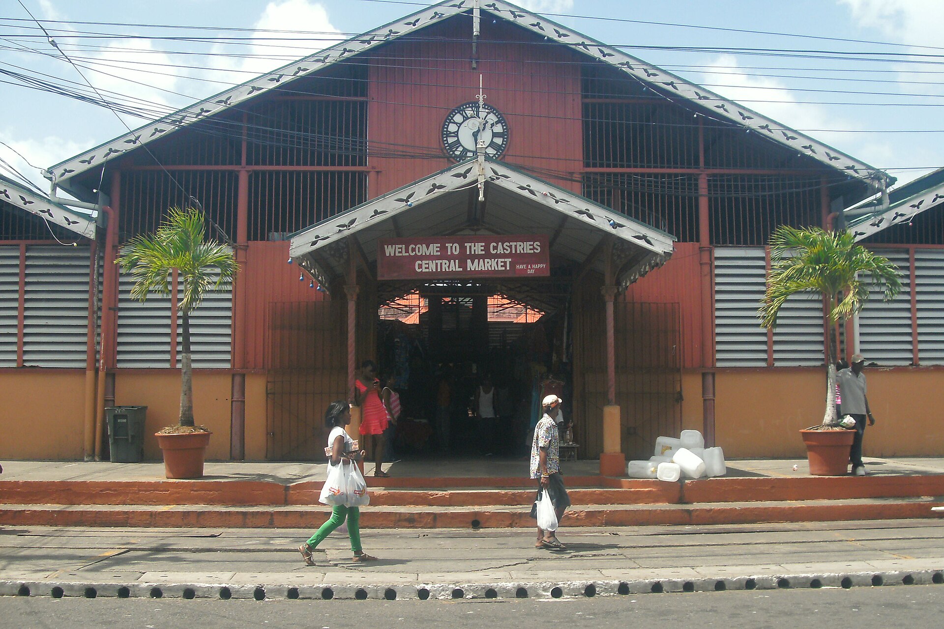
Castries: the capital
Castries is the capital, the main port and the commercial heart of the island. It sits on a flat plain at the head of a deep, sheltered harbour that the French originally called Carénage, a word for a safe place to careen ships. It took the name Castries in the middle of the eighteenth century, in honour of a French nobleman and minister. The district has just under 70,000 people, making it by far the most populous.
A walk through the centre takes in the busy produce market, Derek Walcott Square with its cathedral, duty-free shopping at the harbour and the hill of Morne Fortune above. Cruise ships dock here, and our cruise arrival guide helps plan a day ashore. For more detail, read the Castries guide, and for a sheltered harbour a short drive south, the Marigot Bay guide. The Cathedral and square are described in heritage and historic sites.
Gros Islet and the north
The northern district of Gros Islet holds the island's main resort area, centred on Rodney Bay with its long Reduit Beach, marina and restaurants. The town of Gros Islet, once a quiet fishing village, was promoted to a town in 1985 and is famous for its Friday night street party, where stalls sell grilled fish and chicken and the music spills across the streets. Pigeon Island National Landmark guards the northern headland, and Cap Estate has the island's best-known golf course.
The district also hosts the Daren Sammy National Cricket Stadium, which has staged matches in major international tournaments. If you stay in the north you will find easy access to the northern airport, restaurants and watersports. Read the north Saint Lucia guide, the Rodney Bay guide and the Gros Islet guide, and see cricket culture for the sport that stirs local passion.
The west coast: Anse la Raye, Canaries and Soufrière
South of Castries the road winds along the west coast to Anse la Raye, a fishing town whose name means bay of the rays. It is known for boat building and for its Friday night fish fry, a weekly gathering where locals and visitors eat fresh seafood. Canaries, a small fishing village that once could be reached only by boat, lies a little further on and is the gateway to the rainforest interior and Mount Gimie.
Soufrière is the original French capital and the centre of the island's most scenic area. The town sits beside a bay with the Pitons close by, and nearby are Sulphur Springs, the Diamond Botanical Gardens, cocoa estates and some of the island's most famous hotels. The Anse la Raye guide, Soufrière guide and west coast guide explain how to explore. Many visitors plan a stay here, and our guide to where to stay lists the options.
The south: Choiseul, Laborie and Vieux Fort
Further south, Choiseul is a quiet district known for its traditional crafts, including woven baskets, grass mats and coal pots, as well as for old plantation sites such as Balenbouche. The village of Laborie, named after a French governor of the 1780s, is a fishing community with a calm bay and a long beach, and it has a reputation for being relaxed and unspoilt.
Vieux Fort, at the southern tip, is the island's gateway for international flights, home to Hewanorra International Airport, a commercial port and a growing industrial area. Its name comes from an old fort that watched the sea towards Saint Vincent, and the windy coast nearby attracts kitesurfers. See the Choiseul guide, Laborie guide, Vieux Fort guide and the south Saint Lucia guide.
The east: Micoud and Dennery
The Atlantic coast is the quietest part of the island. Micoud is a district of banana and farmland, fishing villages and the sweep of Praslin Bay, and it is the birthplace of the cricketer Daren Sammy. Near Praslin you will find Mamiku Gardens and the offshore Frigate Island Nature Reserve, which shelters nesting seabirds.
Dennery lies further north on the same coast and is a fishing town with a lively weekend fish fiesta. The district contains much of the Mabouya Valley, a green farming area, and community-led projects at Fond d'Or give a glimpse of old sugar technology and Amerindian settlement. The Dennery guide and east coast guide describe what to see, and our guide to community tourism shows ways to meet local people.
What each district is known for
If you want a quick way to remember the island, the districts can be summed up by their personalities. The north is for beaches, nightlife, sport and sailing. Castries is for markets, government and the harbour. The west is for fishing, scenery and volcanoes. The south is for crafts, calm and the airport, and the east is for wild coast, farmland and quiet.
- Gros Islet: Rodney Bay, Pigeon Island, the Friday street party and golf.
- Castries: the capital, market, harbour and Morne Fortune.
- Anse la Raye: fishing, boats and Friday night fish.
- Canaries: a small fishing village on the road to the interior.
- Soufrière: the Pitons, Sulphur Springs, gardens and cocoa.
- Choiseul: crafts, old estates and quiet beaches.
- Laborie: a relaxed fishing village and calm bay.
- Vieux Fort: the airport, port and windy southern coast.
- Micoud: Praslin Bay, farms and Mamiku Gardens.
- Dennery: fishing, the Mabouya Valley and Fond d'Or.
Getting between towns
Roads connect the towns, but travel is slower than distances suggest because the routes climb and bend around hills. A modern highway links Castries with the southern airport, and the scenic west coast road links Castries with Soufrière. Minibuses serve most routes at low cost, while taxis and hired drivers are the easiest option for visitors. Our getting around guide gives costs and tips.
Choose a base that suits your plans. The north works for beaches and nightlife, Soufrière for scenery and hiking, and Vieux Fort for a night near the airport. The explore section and itineraries help you decide how to divide your time, and the transport and infrastructure guide describes the road network and airports.
Questions travellers ask
How many districts are there in Saint Lucia?
There are ten: Anse la Raye, Canaries, Castries, Choiseul, Dennery, Gros Islet, Laborie, Micoud, Soufrière and Vieux Fort. They were formerly called quarters.
Is Saint Lucia divided into parishes?
Not in everyday use. Saint Lucia is divided into ten districts, called quarters in colonial times, so people who search for parishes will find the same ten areas listed here.
What is the capital of Saint Lucia?
Castries is the capital, main port and largest centre. It lies on the northwest coast around a deep, sheltered harbour and is where cruise ships dock.
Which district has the main resorts?
Gros Islet in the north is the main resort area, centred on Rodney Bay with its beach and marina, though Soufrière in the southwest has many well-known luxury hotels.
Where is the Friday night street party?
The best-known street party is in the town of Gros Islet in the north, where stalls sell grilled food and local beer. Anse la Raye has a Friday fish night too.
Where are the Pitons?
The Pitons stand beside the sea near Soufrière on the southwest coast, between Soufrière and Choiseul. Soufrière is the usual base for visiting them.
Where does my international flight land?
Most international flights land at Hewanorra International Airport at Vieux Fort in the south. Smaller regional flights use the airport near Castries.
Is the east coast worth visiting?
Yes, if you enjoy quiet scenery, farmland and community projects. It is less developed, with rougher seas, and suits day trips from a base elsewhere.
Which district is best for a first visit?
Many first-time visitors split their stay between Gros Islet for beaches and Soufrière for scenery. The two areas offer very different views of the island.
Do the districts have their own guides on this site?
Yes. Each area has its own page in our explore section, covering sights, food and activities, and you can use them to plan day trips and a base.
Saint Lucia on the map
Saint Lucia lies in the Windward Islands of the eastern Caribbean, around 13.8830 degrees north, 60.9670 degrees west. Map data from OpenStreetMap contributors.
Ask Lucy about Districts and towns
Ask about places to stay, things to do, the weather or getting here.
Keep exploring Saint Lucia
Looking for the industry view? Visit St Lucia on VisitTravelGroup.com covers the destination for travellers and the tourism trade.
More from the Visit Travel Group network: VisitTravelGroup.com, Benidorm.co.uk, Anguilla.co.uk, TheRedSea.co.uk.