About Saint Lucia
The Geography of Saint Lucia: Mountains, Bays and a Compact Island
Saint Lucia is small enough to cross in an afternoon yet steep enough that a short journey can take an hour, and almost everything about a visit follows from that.
A small island with a big profile
Saint Lucia covers about 616 square kilometres, or roughly 238 square miles, which is about one and a half times the size of the Isle of Wight. From the northern tip near Pointe du Cap to the southern tip at Ministre Point it measures about 43 kilometres, and at its widest it is only around 22 kilometres across. The coastline runs to roughly 158 kilometres, much of it cut into coves and sheltered bays.
Numbers like these suggest an easy island, but the land is anything but flat. Saint Lucia is the exposed top of a volcanic mountain range rising from the seabed, so even the narrow strip between the Caribbean and the Atlantic is crumpled into ridges, ravines and sharp little valleys. The result is a place where the drive from one side to the other is short on the map and slow on the road. Our guide to the island's geology explains how that landscape was made.
Where Saint Lucia sits in the Windward Islands
The island lies in the eastern Caribbean, part of the Lesser Antilles chain that curves from the Virgin Islands towards South America. Within that chain it belongs to the Windward Islands, the southern group that takes the brunt of the northeast trade winds. Martinique lies a short sea crossing to the north, and Saint Vincent is to the south. Barbados sits out in the Atlantic to the southeast and is the nearest large neighbour for many flight connections.
The Caribbean Sea washes the western shore and the Atlantic Ocean breaks on the east, and the contrast between the two is one of the first things visitors notice. The west is calm and sheltered, the home of most beaches, resorts and harbours. The east is wilder, with surf, reefs and fewer people. If you want to see how the island sits in the wider region, the About Saint Lucia hub gathers the other background guides, and getting here shows how the position affects flights and ferries.
Mountains and the central spine
A rugged chain of forested mountains runs down the middle of the island from north to south. The highest point is Mount Gimie, at about 950 metres, or a little over 3,100 feet, set in the central range inland from the west coast. It is clothed in rainforest and often wrapped in cloud, and it can be climbed with a guide. Our Mount Gimie hikes guide covers the routes and what to expect underfoot.
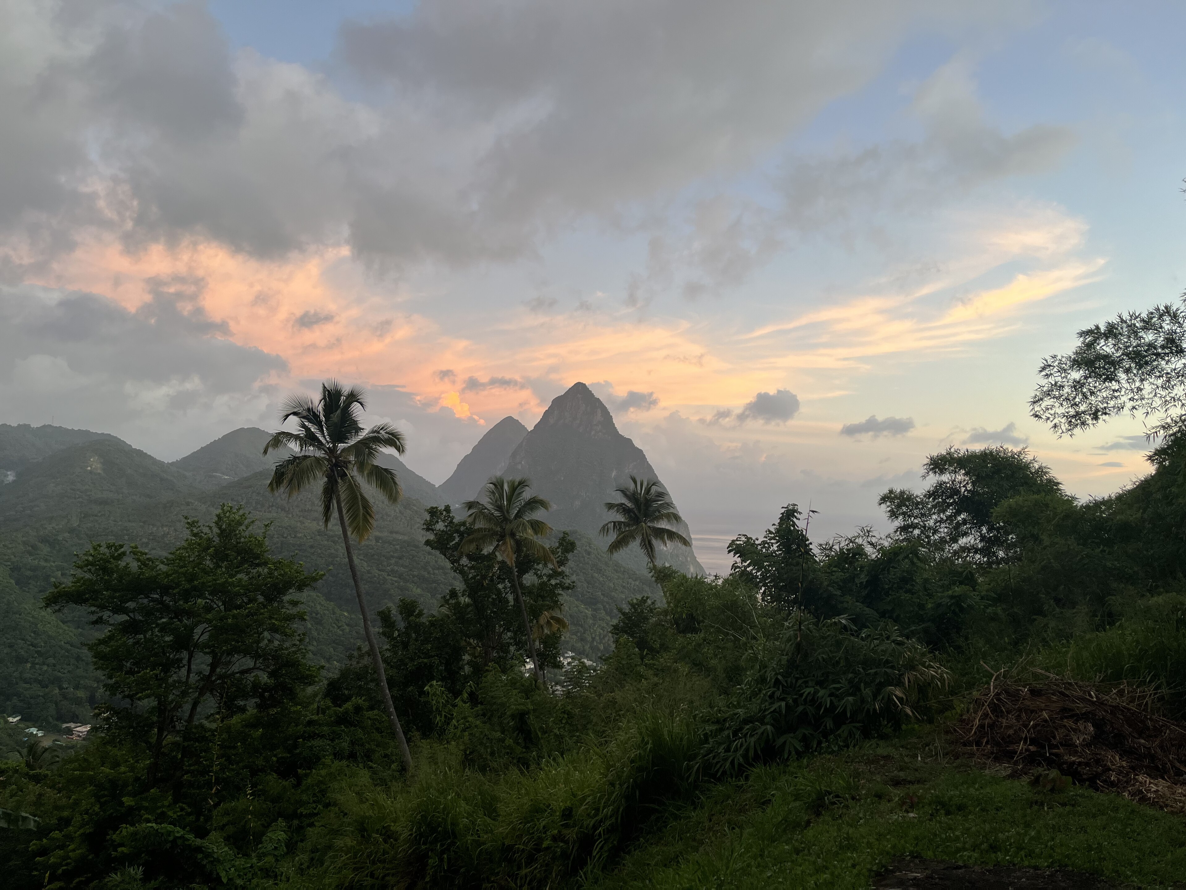
The two most famous summits are lower. Gros Piton rises to about 798 metres and Petit Piton to about 743 metres, yet they look far taller because they spring straight out of the sea. They are volcanic plugs on the southwest coast, joined by a ridge called the Piton Mitan, and they have become the image most people carry home. You can read more in the Pitons guide. Inland, the central ridge catches the clouds, which is why the interior is so green and why the rivers never quite run dry.
- Mount Gimie: the highest point, about 950 metres.
- Gros Piton: about 798 metres, the more climbed of the two.
- Petit Piton: about 743 metres, steeper and for experienced scramblers.
- The central range: forest reserves, trails and the island's main water catchment.
Rivers, valleys and farmland
Because the mountains catch so much rain, short, fast rivers tumble from the central range to both coasts. None is long, but several have carved broad valleys that became the island's farmland. The Roseau Valley in the west, the Cul de Sac Valley and the Mabouya Valley in the east have all been important banana country, and you will drive through their green fields on the way between towns. The story of that crop is told in our guide to agriculture and bananas.
The rivers also feed the waterfalls that visitors love, such as the cascades around Soufrière and the plunge pools tucked into rainforest gorges. Our guide to waterfalls and gardens picks out the easiest ones to reach. In the wet season the rivers can rise quickly and burst their banks, so heed local advice before swimming in a freshwater pool after heavy rain.
Coasts, bays and beaches
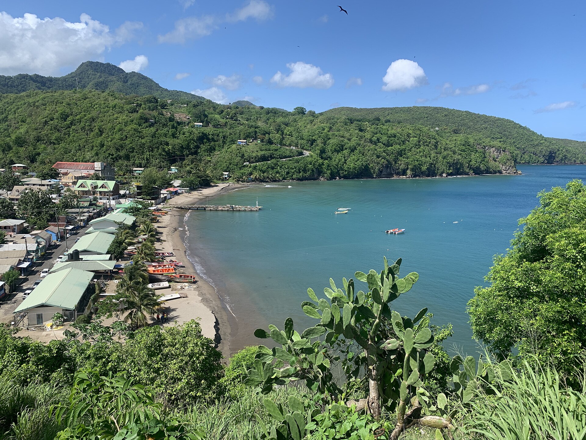
The west coast has most of the sheltered bays. Rodney Bay in the north is a wide, horseshoe-shaped bay with a marina and the long sweep of Reduit Beach. Marigot Bay, a little further south, is a deep, narrow inlet that sailors treasure as a safe harbour. Further south again, the coast folds into small coves such as those below the Pitons, where the sand is darker because of its volcanic origin. Our guides to the best beaches and black sand beaches show the range.
The east coast faces the Atlantic and has a different character. Surf pounds rocky headlands, the sea is rougher, and many beaches are better for walking than swimming. The far south, around Vieux Fort, is flatter and windier, and it is where the main international airport sits. If you plan to swim, read beach safety first, because Atlantic-facing beaches can have strong currents.
Districts and offshore islands
Saint Lucia is divided into ten districts, which were once called quarters: Anse la Raye, Canaries, Castries, Choiseul, Dennery, Gros Islet, Laborie, Micoud, Soufrière and Vieux Fort. Castries is the capital and the largest centre. Our districts and towns guide describes what each is known for, and the explore section offers a visitor's view of every area.
A handful of small islands lie just offshore. Pigeon Island was once a true island but has been joined to the mainland by a causeway since the early 1970s, and it is now a national landmark. In the southeast, the Maria Islands form a nature reserve and are noted for rare reptiles. Frigate Island lies off the east coast near Dennery and is also protected. Our offshore islands guide explains which can be visited and how.
How geography shapes your trip
The steep terrain means that distances are deceptive. The main route down the west coast between Castries and Soufrière is only a little over forty kilometres, yet it winds through hairpin bends and can take well over an hour. Vieux Fort, where the main international airport sits, is a long drive from the resorts in the north, so check your transfer time before booking. Our getting around guide sets out the realistic options.
It also means that you can sample many landscapes in a week. A morning on a gentle northern beach, an afternoon in a rainforest, a night beneath the Pitons and a day on a boat along the west coast are all within reach. For ideas on how to stitch it together, see our iconic Saint Lucia itinerary and the guide to how many days to stay. The island rewards a base in one or two areas rather than constant moving.
Questions travellers ask
How big is Saint Lucia?
Saint Lucia covers about 616 square kilometres, or roughly 238 square miles. It is about 43 kilometres from north to south and around 22 kilometres across at its widest.
Where is Saint Lucia in the Caribbean?
It lies in the eastern Caribbean as part of the Windward Islands, with Martinique to the north, Saint Vincent to the south and Barbados to the southeast.
What is the highest point on Saint Lucia?
Mount Gimie, in the central mountain range, is the highest point at about 950 metres. It is covered in rainforest and can be climbed with a guide.
How tall are the Pitons?
Gros Piton is about 798 metres high and Petit Piton about 743 metres. They look taller because they rise directly from the sea on the southwest coast.
How many districts does Saint Lucia have?
There are ten districts: Anse la Raye, Canaries, Castries, Choiseul, Dennery, Gros Islet, Laborie, Micoud, Soufrière and Vieux Fort.
Does Saint Lucia have rivers?
Yes. Many short rivers run from the central mountains to both coasts, and they feed the waterfalls and the fertile valleys where bananas and other crops are grown.
Is the east coast good for swimming?
The Atlantic coast is rougher, with stronger surf and currents, so the sheltered west coast is generally better for swimming. Always check local advice at each beach.
Can you visit the offshore islands?
Pigeon Island is joined to the mainland and is easy to visit. Some other islands are protected nature reserves and can be visited only with permission or a guided tour.
Why does it take so long to drive across such a small island?
The roads climb and twist around steep ridges and ravines, so a short distance on the map can take an hour or more, especially on the west coast road.
Saint Lucia on the map
Saint Lucia lies in the Windward Islands of the eastern Caribbean, around 13.8830 degrees north, 60.9670 degrees west. Map data from OpenStreetMap contributors.
Ask Lucy about Geography
Ask about places to stay, things to do, the weather or getting here.
Keep exploring Saint Lucia
Looking for the industry view? Visit St Lucia on VisitTravelGroup.com covers the destination for travellers and the tourism trade.
More from the Visit Travel Group network: VisitTravelGroup.com, Benidorm.co.uk, Anguilla.co.uk, TheRedSea.co.uk.