Things to do
Mount Gimie: Hiking to the Roof of Saint Lucia
Everyone photographs the Pitons, but the island's highest summit is Mount Gimie, reached through mist, roots and rainforest.
The hike at a glance
Mount Gimie stands at roughly 950 metres, or 3,117 feet, and is the highest point on the island. The route is a challenging rainforest climb of about 6 to 10 kilometres there and back, depending on the variation and access point, with around 600 metres of vertical ascent. Expect five to seven hours in total including breaks, with the pace and conditions deciding where in that range you land.
The terrain is steep and uneven, with roots, rocks and a good deal of mud. This is not a stroll, and it rewards people who enjoy a physical day more than an easy view. If you want something gentler, our hiking and rainforest guide covers other trails.
Where it starts
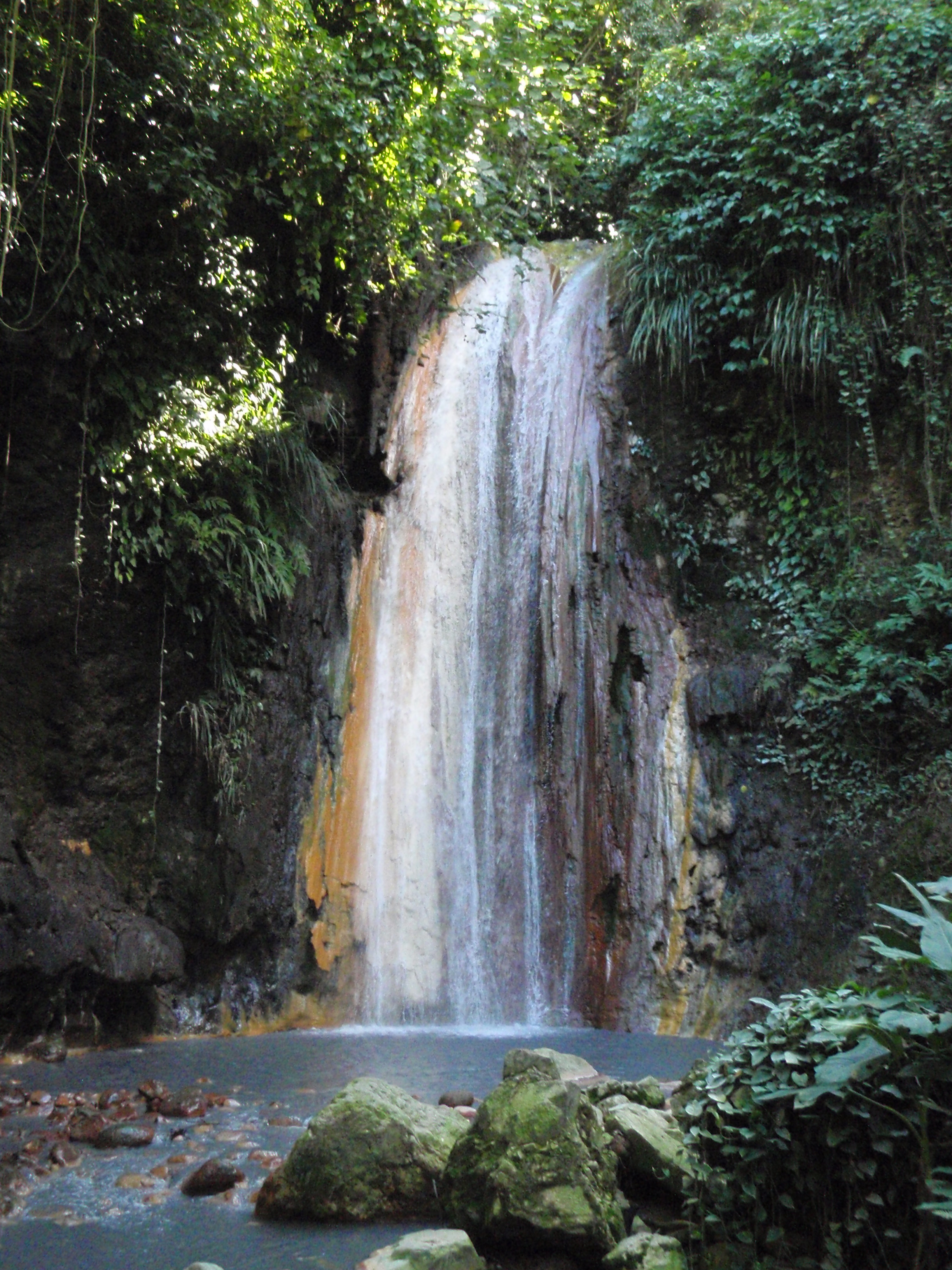
The trek begins in the Edmund Forest Reserve, reached through the Migny and Quilesse area near Soufrière. That puts it in the wet interior behind the coast, in the same part of the island as the waterfalls and cocoa estates. The area also feeds the streams that tumble down toward the sea in the south of Saint Lucia.
What you will see
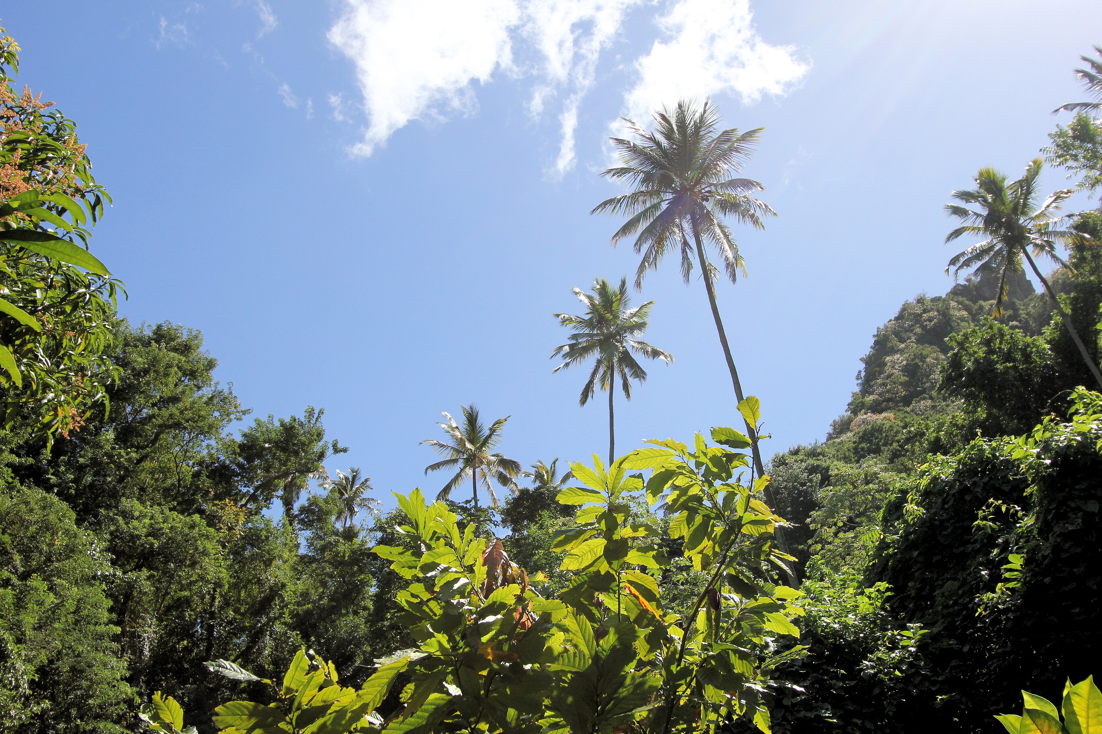
Dense tropical rainforest, native plants and birdlife found nowhere else surround you for most of the climb. Temperatures drop with elevation, which is a relief after the humid lower slopes. On a clear day the summit gives a sweeping view over the mountainous interior. Cloud is common, though, and the mist adds to the atmosphere of the place even when the view disappears.
Birders in particular should keep their eyes and ears open; the forest is home to the Saint Lucia parrot, covered in our birdwatching guide. Guides also know the plants, which links to our guide to local plants and traditional uses.
Ways to do it
The classic guided summit trek follows the standard route up through the rainforest with steady inclines, aimed at hikers who want a physical challenge and a panoramic finish. A private guided version offers a flexible pace for small groups or experienced hikers who want extra time for photographs and rests. An extended rainforest route adds more time on the forest trails, possible stream crossings and a stronger focus on plants and birds.
A licensed local guide is strongly recommended. The trails are not always obvious, the weather changes quickly, and guides carry knowledge of conditions you cannot get from a map. Fees help local people too.
What to bring
Preparation matters on a muddy mountain. Wear hiking boots with strong grip and lightweight, breathable clothing, and pack a rain jacket, at least two litres of water per person, energy snacks, insect repellent, sun cream and a small rucksack. A walking stick helps on the muddy sections.
- Start early so you finish well before dark.
- Carry a dry change of socks and clothes for the return.
- Tell someone at your hotel where you are going.
Planning around it
Drier months make the going easier, and our best time to visit guide shows when they fall. Plan a rest afternoon afterwards at a resort such as Ladera, with its view of the Pitons, or a swim at Anse Chastanet. If you want a bigger goal, Mount Gimie is one of three climbs in the Three Peaks Challenge, and if you only want one famous summit read about Gros Piton.
How hard is the Mount Gimie hike in Saint Lucia?
The Mount Gimie hike is one of the hardest in Saint Lucia, a long, muddy rainforest climb to the island's highest point at about 950 metres that needs good fitness, an experienced local guide and most of a day. It is not technical in the way that Petit Piton is, with no ropes or exposed scrambling, but it is relentless. The path climbs through wet forest over roots, loose earth and slick rock, and the mud can be knee-deep in places after rain. Hikers who relish a proper day in the hills will enjoy it, while those who prefer a viewpoint and a cold drink may be happier on gentler trails.
What sets it apart is the sense of remoteness. Most of the island's visitors never leave the coast, and on Mount Gimie you can walk for hours without seeing another person. The air cools as you climb, the sounds change from insects to birds and dripping water, and the cloud often drops into the trees, so that the forest closes around you in a soft grey light. Some people find the mist magical, while others are disappointed to lose the view, and the honest answer is that you cannot know which you will get until you are there.
Pace yourself and trust your guide. A licensed guide knows where the trail forks, which stretches flood and how fast the weather can change, and they will set a rhythm you can keep for many hours. The effort is real, so be honest about your fitness when you book, and consider doing a gentler forest walk first, such as those described in our hiking and rainforest guide. If you are weighing it against the island's famous peaks, our page on climbing Gros Piton sets out how the experiences differ.
What will I see on the Mount Gimie trail?
On the Mount Gimie trail you pass through the Edmund Forest Reserve rainforest, with tree ferns, bromeliads and orchids overhead, listen for endemic birds including the Saint Lucia parrot, and may reach a summit view over the interior or find only cloud. The reserve is a protected mountain forest looked after by the Forestry Department, with a spongy floor, streams, footbridges and mossy trunks. More than thirty species of bird have been recorded there, among them the Saint Lucia warbler, the Saint Lucia oriole and the white-footed finch.
The parrot is the star. It is found only in Saint Lucia, with green plumage, a cobalt forehead and a scarlet breast, and it lives high in the canopy where its colours blend with the leaves. It feeds on fruits, nuts and seeds from forest trees and nests in tree cavities, and it was declared the national bird in 1979 after hunting, habitat loss and the illegal bird trade had pushed it towards extinction. You are far more likely to hear its loud calls than to see it, so stop, stay quiet and let your guide listen for you.
Underfoot, the forest has its own residents. Frogs call after rain, lizards dart across logs, and the island's river crab can be found near the streams. The boa lives here too, though it is shy and rarely seen. For a deeper understanding of why this forest matters, read our background articles on conservation and protected areas and wildlife and ecology, and bring binoculars if you own a pair. Photography is easier in the clearings and at stream crossings than on the steep, wet sections, where your hands are better kept free.
How should I prepare for and recover from Mount Gimie?
Prepare for Mount Gimie by training with long walks, booking a licensed guide ahead, starting at first light and packing water, a rain jacket and spare socks, then recover with a soak at the springs or a swim in the sea. Boots with deep grip matter more than anything else on your feet, and a walking pole helps on the muddy sections. Eat a proper breakfast, carry snacks that survive heat and humidity, and bring more water than you expect to drink. A small waterproof bag for your phone and a change of dry clothing for the car are worth their weight.
Choose your timing with care. The drier months from December to April give firmer paths and a better chance of views, as our best time to visit guide explains, while the wetter season brings the deepest mud and the most cloud. Tell your hotel where you are going and when you expect to return, and make sure your travel insurance covers hiking, which our health, insurance and safety guide discusses. If you are planning a major trekking trip, the Three Peaks Challenge combines this climb with the two Pitons.
Afterwards, be kind to your body. The warm mineral waters and mud at the Sulphur Springs are a classic reward for aching legs, and a quiet evening at a ridge-top resort such as Ladera, with its view of the Pitons, makes the day feel complete. Eat well, drink plenty and sleep early. Most hikers say the satisfaction arrives later, when the mud has dried and the photographs have been shared, and they realise they have stood on the highest ground their island offers.
The highest ground and its protection
The island's high interior is a volcanic landscape, explained in the geology and volcanoes guide. The rainforest and plant life page describes the forest that cloaks it.
This is also a place of conservation, covered by conservation and protected areas, and the climate and hurricanes page explains the rainfall that feeds it. See wildlife and ecology for what lives there.
Where to stay and how to plan
Most visitors fit this into a holiday in St Lucia, so choose your base first. Compare places to stay in St Lucia by area and style, and read our guides to luxury hotels in St Lucia and all inclusive resorts in St Lucia if you are choosing between a boutique stay and an all in package.
Then set your dates with the best time to visit St Lucia, book flights to St Lucia and pick days out from our St Lucia itineraries. Couples can also read about a honeymoon in St Lucia or weddings in St Lucia.
Questions travellers ask
How high is Mount Gimie?
About 950 metres, or 3,117 feet, which makes it the highest point on Saint Lucia.
How long does the hike take?
Allow five to seven hours in total including breaks, depending on your pace and the conditions on the day.
How hard is Mount Gimie?
It is challenging, with steep rainforest trails, roots, rocks and muddy sections. Good fitness is needed.
Do I need a guide?
A licensed local guide is strongly recommended because of the terrain, changing weather and the knowledge they bring.
Where does the trail start?
In the Edmund Forest Reserve, reached through the Migny and Quilesse area near Soufrière.
What can I see from the top?
On clear days there are wide views across the mountainous interior, though cloud cover is common near the summit.
What should I carry?
Boots with grip, a rain jacket, at least two litres of water per person, snacks, repellent, sun cream and a walking stick.
Can I combine it with other climbs?
Yes. Mount Gimie is one of the three peaks in the Three Peaks Challenge, alongside Gros Piton and Petit Piton.
Can you hike Mount Gimie without a guide?
No, a licensed local guide is strongly recommended and the Edmund Forest Reserve requires a ranger or naturalist guide. Trails are not always obvious, and the weather changes quickly, so going alone is unwise.
Is Mount Gimie harder than Gros Piton?
For most hikers it is the longer and more demanding day, because of the distance and mud, though Gros Piton is steeper in places and Petit Piton is the most technical of all. Fitness matters most.
What is the best time of year to hike Mount Gimie?
The drier months from December to April are best, with firmer ground and a better chance of views. The wetter season brings deeper mud and more cloud, so allow a flexible day.
Mount Gimie on the map
Mount Gimie is at 13.8635 degrees north, 61.0111 degrees west. Map data from OpenStreetMap contributors.
Ask Lucy about Mount Gimie hikes
Ask about places to stay, things to do, the weather or getting here.
Keep exploring Saint Lucia
Looking for the industry view? Visit St Lucia on VisitTravelGroup.com covers the destination for travellers and the tourism trade.
More from the Visit Travel Group network: VisitTravelGroup.com, Benidorm.co.uk, Anguilla.co.uk, TheRedSea.co.uk.