About Saint Lucia
Geology and Volcanoes: The Fire Beneath Saint Lucia
Saint Lucia is a volcanic island that is still quietly alive, and you can stand beside steaming vents, soak in warm water and look up at lava plugs in a single day.
An island born of fire
Saint Lucia belongs to the Lesser Antilles, an arc of volcanic islands created where one tectonic plate slides beneath another. Here the Atlantic seabed is pushed down beneath the Caribbean plate, and the melting rock that rises above it feeds volcanoes along the chain. The island is therefore not coral or limestone, as in the Bahamas, but the solid remains of volcanoes built up over a very long time.
The north is generally older and more worn down, with smoother hills and wider bays. The most recent volcanic activity lies in the southwest, around Soufrière, which is why that corner is so dramatic. If you want to see how this shapes the lie of the land, our geography guide describes the mountains, rivers and coasts that this volcanic past has left behind.
The Qualibou caldera
The great volcanic feature of the south is the Qualibou, also known as the Soufrière Volcanic Centre. It is a collapsed crater, or caldera, a few kilometres across, formed in a very large eruption tens of thousands of years ago. Geologists link that eruption to a thick blanket of volcanic material, known as the Choiseul Tuff, which spread across the southeastern part of the island.
Within the caldera floor, later eruptions built a scatter of smaller lava domes, and heat still rises from below. The town of Soufrière sits on the rim and edge of this basin, and the name means sulphur mine in French, a nod to the smell of the nearby vents. Smaller steam explosions have happened in the historic period, and a minor eruption of steam and ash was recorded in 1766. Today the Qualibou is classed as dormant rather than extinct, and its activity is watched closely.
The Pitons
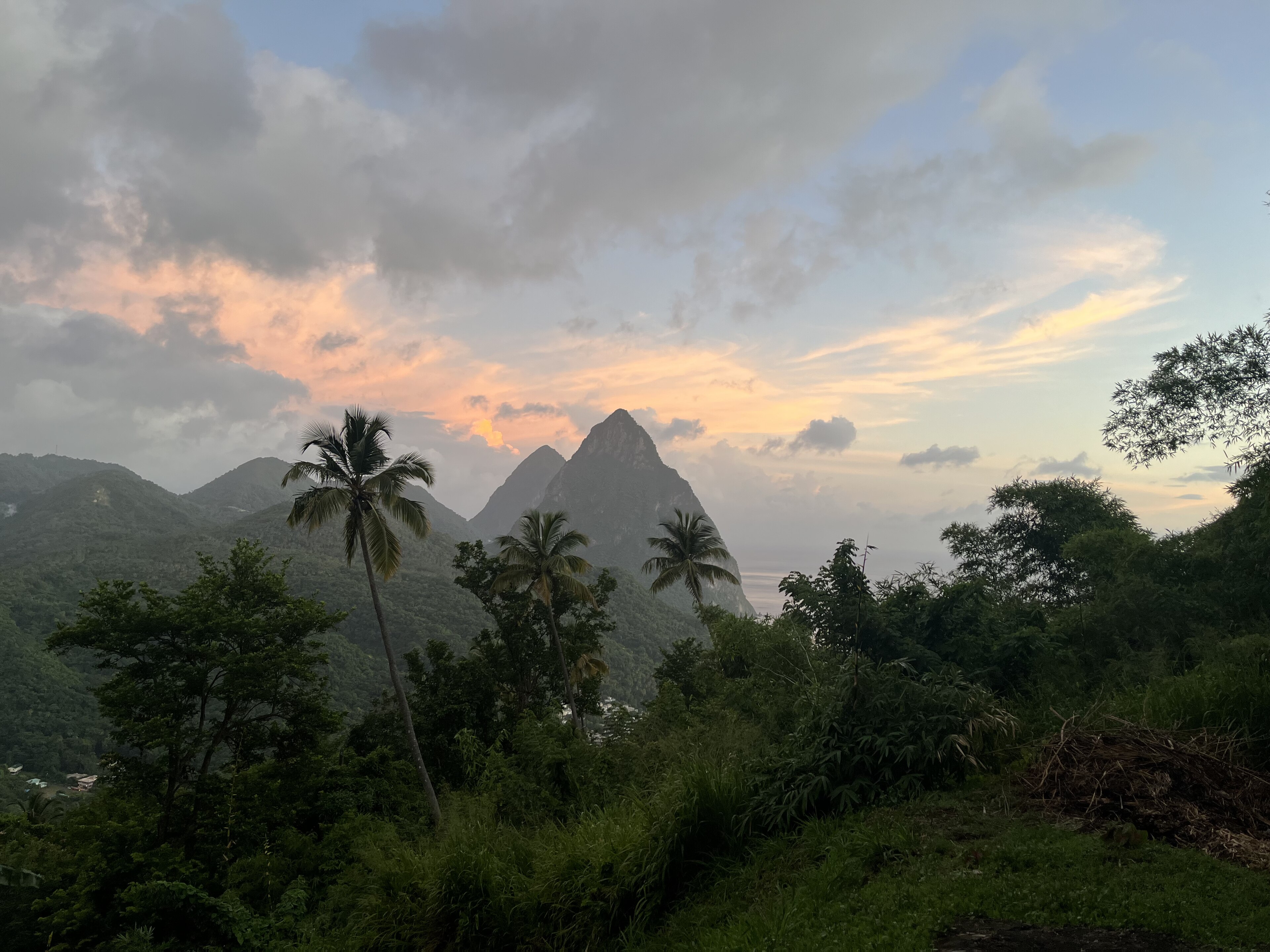
Gros Piton and Petit Piton are two steep lava domes, or volcanic plugs, on the southwest coast. They formed a few hundred thousand years ago, before the caldera collapsed, when thick lava was squeezed up and set hard in the vent. Over time the weaker surrounding rock eroded away, leaving the twin spires we see now. They stand on the edge of the sea at about 798 and 743 metres, and they were inscribed as a World Heritage Site in 2004.
You can see them from boats, beaches and nearly every resort on the southwest coast, and you can climb Gros Piton with a guide on a steep but non-technical trail. Our Pitons guide and the Gros Piton hike guide have practical details. Locals tell a gentler story too, seeing the pair as parent and child, with a small spur on Petit Piton known as the third, little peak. For the heritage listing, see heritage and historic sites.
Sulphur Springs: the drive-in volcano
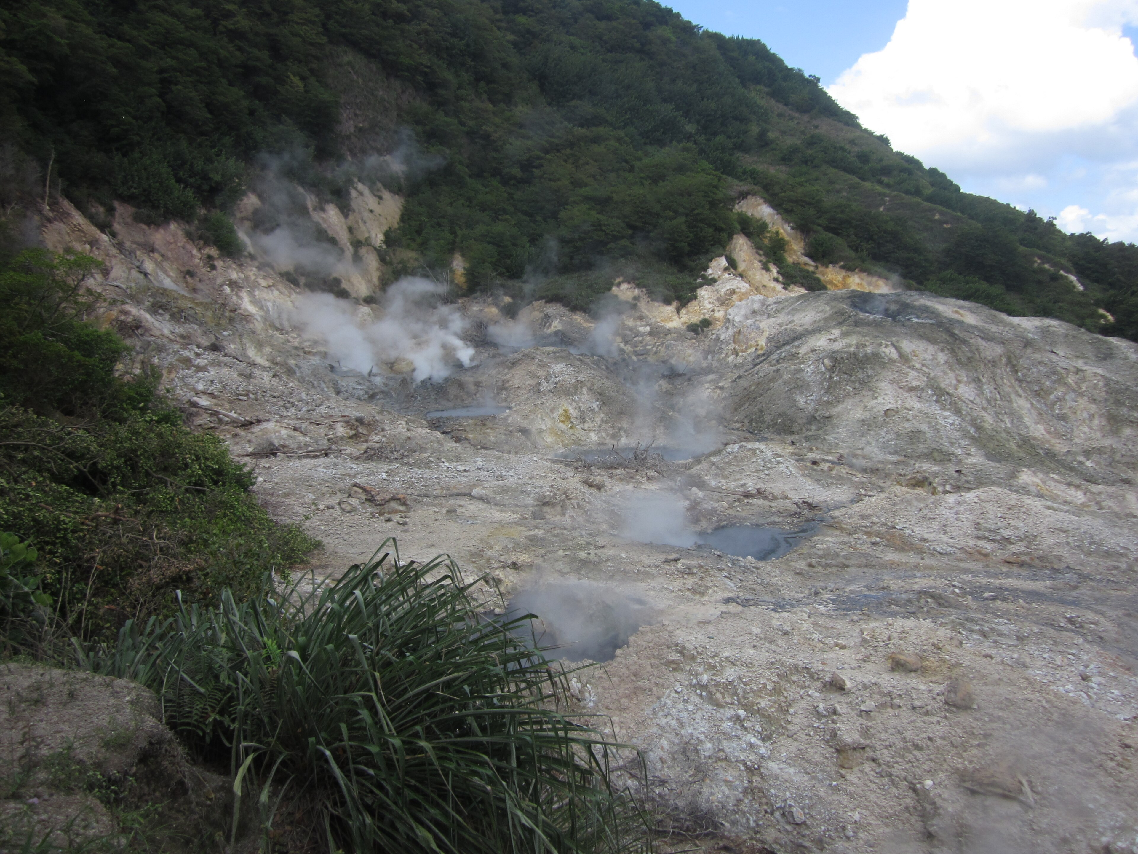
The best-known geothermal site is Sulphur Springs, near Soufrière, often described as the world's only drive-in volcano. That is a marketing phrase, but the idea is true enough: a road leads right into the caldera, where gas escapes from cracks in the ground and boiling water bubbles in grey, rust and yellow pools. The steam can reach roughly the boiling point of water, and the smell of sulphur is strong.
Visitors used to walk close to the pools, but after a guide fell through the crust in the 1990s and suffered burns, access was restricted and viewing is now from a platform at a safe distance. A local guide will explain what you are seeing, and the site is a good first stop on a southern day tour. Our Sulphur Springs guide covers opening times, tickets and what to bring, and the Soufrière area guide shows what else is nearby.
- Stay on marked paths and viewing platforms, because the ground can be thin over boiling water.
- Wear shoes you do not mind getting stained, and bring a change of clothes if you plan to bathe.
- Go with a guide, who can explain the vents and keep you away from danger.
Hot springs, mud and mineral baths
The same heat that drives the vents warms springs that run downhill. A short way below Sulphur Springs the water is hot but cool enough to bathe in, and many visitors coat themselves in warm grey mud and rinse off in the stream. People have used these waters for centuries. In 1784 the French governor sent samples to Paris for testing, and baths were built at what is now the Soufrière Estate, where a sulphurous waterfall runs through the Diamond Botanical Gardens.
These experiences are the basis for the island's spa tradition. Our guide to spa rituals and mud baths describes treatments, and the waterfalls and gardens guide explains how to combine a garden visit with a soak. Remember that mineral water can stain swimwear and jewellery, and that medical claims for the waters are traditional rather than proven.
Black sand and a volcanic coastline
Beaches in the south tend to be darker than the pale sand of the north, because the sand is made from weathered volcanic rock rather than crushed coral. Near the Pitons you will find grey, brown and nearly black sand that gets hot in the midday sun but photographs beautifully against green hills. Pumice, a light volcanic rock, is also found on the island and has been quarried.
The coast itself is shaped by this volcanic history, with steep headlands dropping into deep water, which is why diving and snorkelling are so rewarding off the southwest. Underwater, old lava flows and rock walls have become homes for coral and fish. Read our black sand beaches guide for where to go, and diving and snorkelling for the underwater side.
Earthquakes, eruptions and hazards
Living on an active volcanic arc brings risk, and Saint Lucia takes it seriously. Small earthquakes are felt now and then, and swarms of shallow tremors were recorded near the Qualibou in 1990, 1999 and 2000. Soufrière also felt a notable earthquake in 1991. None of these led to an eruption, but they are reminders that the system is alive. The Seismic Research Centre at the University of the West Indies monitors the volcanoes of the eastern Caribbean, and the island has a national disaster agency that issues warnings.
Other hazards are more familiar. Steep slopes mean landslides after heavy rain, and the coast faces hurricane season each year, as described in our guide to climate and hurricanes. For visitors the practical risks are small: stay on paths at geothermal sites, take care on wet hillsides, and follow guidance from your hotel and local authorities if there is ever an alert. See also health, insurance and safety.
How to visit the volcanic sights
A classic day in the south links Sulphur Springs, the mud baths, the Diamond Botanical Gardens and a view of the Pitons, with lunch at a plantation or in Soufrière. It is easy to organise by taxi or on a tour, and our land tours guide lists options. Start early to beat both the heat and the cruise crowds, and take water, sun protection and a light waterproof.
If you want to go further, hike Gros Piton in the cool of the morning, take a boat to see the Pitons from the sea, or book a helicopter flight for a view of the whole caldera from above (see helicopter tours). Most travellers find that one or two volcanic stops are enough to understand the island's character, with the rest of the time spent on beaches, trails and food.
Questions travellers ask
Is Saint Lucia a volcanic island?
Yes. It was built by volcanoes in the Lesser Antilles arc, and the southwest still has hot springs and steaming vents around the Qualibou caldera.
Is there an active volcano in Saint Lucia?
The Qualibou volcanic centre near Soufrière is dormant but geothermally active, with Sulphur Springs as its most visible sign. Its activity is monitored.
When was the last eruption?
A minor steam and ash explosion was recorded at Sulphur Springs in 1766. There has been no eruption in the modern era, though small earthquakes are felt occasionally.
What is the Qualibou?
The Qualibou is a collapsed volcanic crater, or caldera, a few kilometres across near Soufrière. Sulphur Springs lies in its centre and the town sits on its edge.
How were the Pitons formed?
They are lava domes that formed a few hundred thousand years ago. The softer rock around them eroded away, leaving the twin spires standing beside the sea.
Can you walk up to the boiling pools at Sulphur Springs?
No. After an accident in the 1990s, visitors view the pools from a safe platform. A guide explains the site, and you can bathe in the warm stream below.
Are the mud baths safe?
They are popular and generally safe in the cooler stream water below the vents, but test the temperature, avoid open wounds and check with a doctor if you have health concerns.
Why is some Saint Lucian sand dark?
Sand near the Pitons comes from weathered volcanic rock, so it appears grey, brown or almost black, unlike the pale coral sand found on many other Caribbean islands.
Should visitors worry about earthquakes?
Small tremors happen but are rarely felt by visitors. Follow your hotel's guidance and local alerts, and carry travel insurance as you would anywhere in the Caribbean.
The Pitons on the map
The Pitons is at 13.8220 degrees north, 61.0650 degrees west. Map data from OpenStreetMap contributors.
Ask Lucy about Geology and volcanoes
Ask about places to stay, things to do, the weather or getting here.
Keep exploring Saint Lucia
Looking for the industry view? Visit St Lucia on VisitTravelGroup.com covers the destination for travellers and the tourism trade.
More from the Visit Travel Group network: VisitTravelGroup.com, Benidorm.co.uk, Anguilla.co.uk, TheRedSea.co.uk.