About Saint Lucia
French and British Rule in Saint Lucia: The Long Contest
Few islands of Saint Lucia's size have been fought over so fiercely. For roughly a century and a half, French and British soldiers, sailors and diplomats argued over its harbours, and the stone forts and treaties they left behind are among the best things to explore today.
Why everyone wanted Saint Lucia
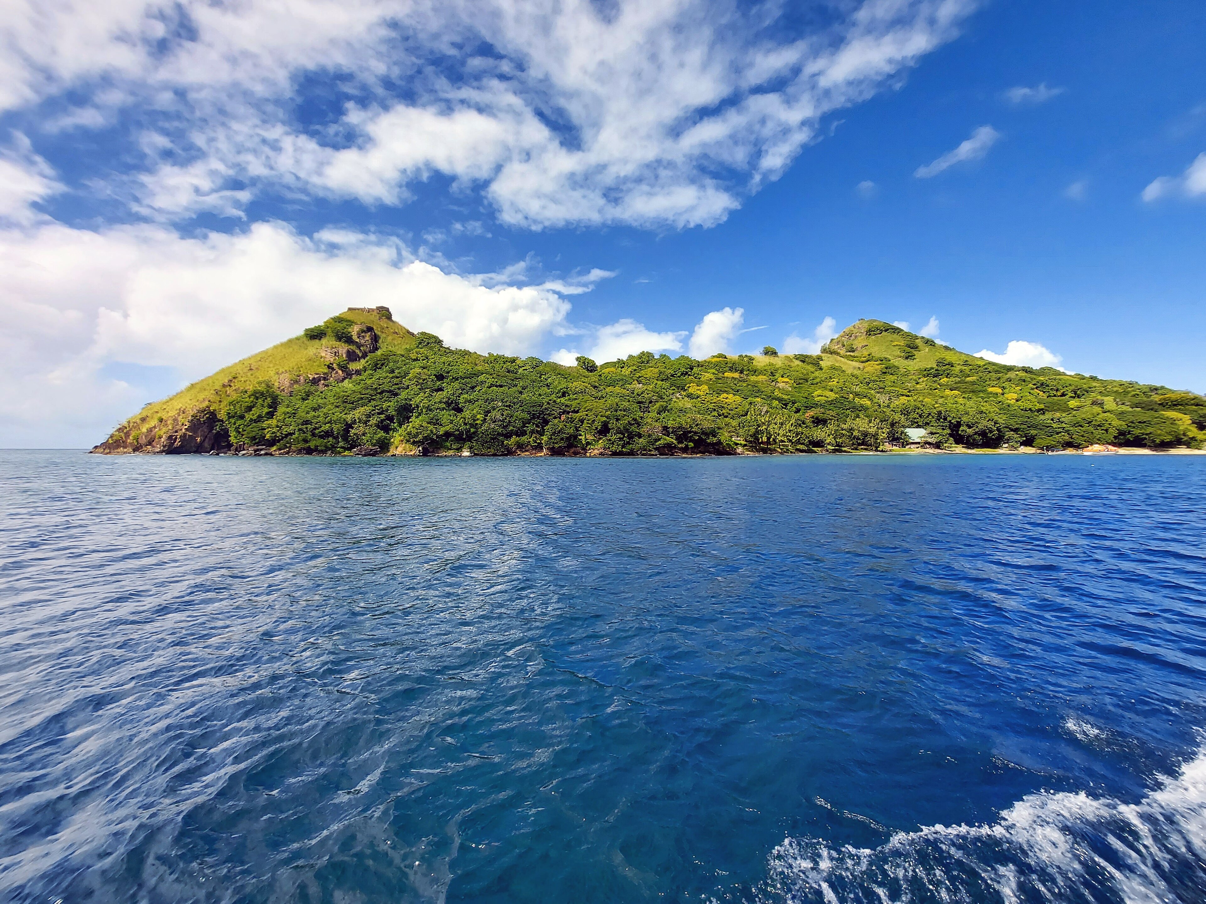
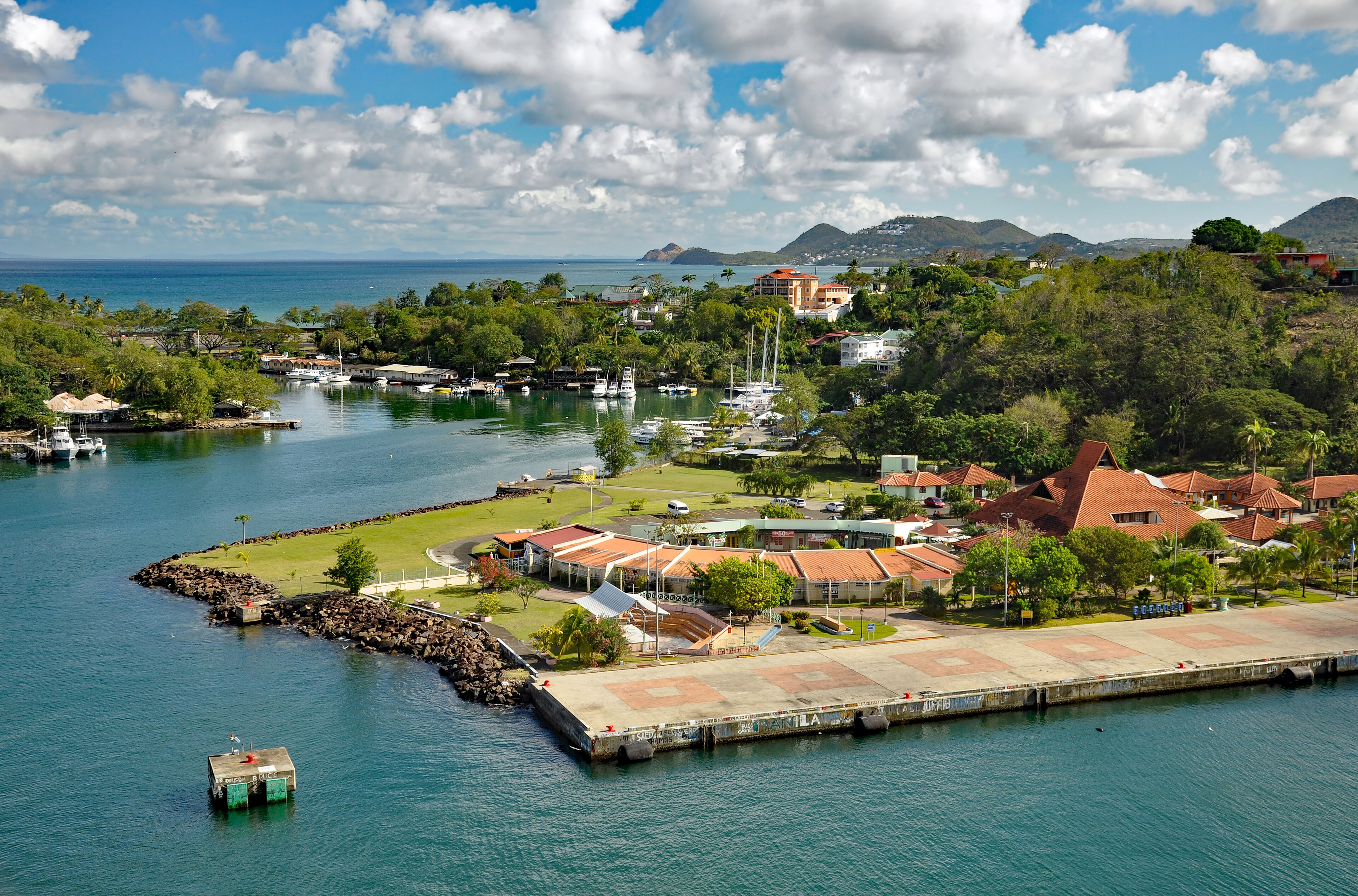
Saint Lucia was valuable for reasons of position. It lies between Martinique, the French naval and administrative centre, and Barbados, the base of the British in the Eastern Caribbean. Its main harbour, where Castries now stands, is deep and sheltered. Its northern headland, Pigeon Island, offers a clear view of Martinique. Whoever held Saint Lucia could watch and threaten the other side.
Sugar added a second motive. Once plantations spread after 1763, the island promised profit as well as strategy, and both empires were willing to spend lives and money to hold it. The usual tally is that control changed hands fourteen times, though the number depends on how you count occupations, neutrality agreements and brief captures. That unusual record earned the island the nickname you can read about in our history of Saint Lucia, Helen of the West Indies.
France gets a foothold
After failed attempts by the Dutch and English, the French settled in the middle of the seventeenth century, working from Martinique. Saint Lucia was run as a dependency of Martinique, and in 1674 it became a formal French crown colony. The English did not give up. They invaded in 1663 and again in the mid 1660s, but disease and Kalinago resistance wore them down, and diplomacy returned the island to France. The Treaty of Breda in 1667 confirmed French control, and in 1687 and 1697 Britain withdrew its claims for the time being.
Early French Saint Lucia was a modest place. Settlers farmed small plots, traded with the Kalinago and gradually spread along the west coast. Names from this period remain on the map, and the sheltered coves between Castries and Soufrière still bear French names. The story of how the first settlers and their rivals arrived is told in first peoples and European contact.
Sugar and the eighteenth century scramble
The eighteenth century was a restless one. In 1722 King George I granted Saint Lucia and Saint Vincent to the Duke of Montagu, who sent an adventurer called Nathaniel Uring to settle it, but French forces quickly drove him out. The French took firm control in 1744. During the Seven Years War the British occupied the island in 1762, yet handed it back under the Treaty of Paris on 10 February 1763. That peace turned out to be the start of the plantation boom, as French investors cleared land for sugar.
The French also reorganised their military base. In 1765 they moved their headquarters and government buildings from the Vigie headland to the hill above Castries, which was renamed Morne Fortuné, now generally written Morne Fortune. A strong citadel was completed there in 1784. The move reflected the importance of the harbour below, and it explains why the hill is such a good place to understand the island's defences, as our guide to historic forts and ruins shows.
The American war, Fort Rodney and the Saintes
France supported the American colonies in their revolt against Britain, and the Caribbean became a second battlefield. In December 1778 the British landed and took Saint Lucia in the fighting around the Grand Cul de Sac, and they made it a naval base. Admiral George Rodney fortified the northern headland between about 1779 and 1782. That fort, Fort Rodney, stands on Pigeon Island, not on Morne Fortune, and from the higher peak the British could watch the French fleet at Fort Royal on Martinique.
In April 1782 Rodney sailed from this base and defeated a French fleet under the Comte de Grasse at the Battle of the Saintes, fought between 9 and 12 April off Dominica. It was a famous British victory that helped shape the peace that followed. Even so, the treaties of 1783 returned Saint Lucia to France in 1784. You can walk the ruins today, with the barracks, the officers' quarters and the signal hill, and our guide to Pigeon Island explains what to see. Rodney's name also lives on in Rodney Bay, where many visitors stay.
Revolution, war and the final turn of the wheel
The French Revolution reached the island in the 1790s and split it. The National Convention abolished slavery in French territories in February 1794, and the British, anxious to protect the sugar estates, invaded in April 1794 and renamed the citadel on Morne Fortune Fort Charlotte, after the queen. There followed the Brigands' War, a struggle in which freed people and their allies drove the British out in 1795, before a larger British force under Sir Ralph Abercrombie returned in 1796. The French garrison surrendered at Morne Fortune on 25 May 1796, and John Moore became military governor. We tell the human side of that struggle in slavery and emancipation.
The Peace of Amiens gave the island back to France in 1802, and Napoleon reinstated slavery. British forces took it again in June 1803, and the two countries fixed the matter in the Treaty of Paris of 1814, which ended the Napoleonic Wars. Saint Lucia was among the few French colonial gains that Britain kept, alongside Tobago, Mauritius and the Seychelles. After that the island stayed British until independence in 1979.
A British colony in the Windwards
Under British rule Saint Lucia became a Crown colony, governed through a governor and a council rather than by its own elected assembly. After slavery ended in 1838 the island was grouped with the Windward Islands for administration, with the governor based at Barbados until the headquarters moved to Grenada in 1885. Limited representative government came only in 1924, with universal adult suffrage following in 1951, and you can follow the rest of that road in independence and modern history.
The British also changed Castries. The port became a coaling station for steamships, and the military garrison on Morne Fortune kept soldiers of the West India Regiment on the hill. Fort Charlotte was abandoned in 1905, and a school now stands on part of the site. The early British period also brought the legal system, the parliamentary traditions and the English language of government that remain today, which our page on government and politics describes.
What the French left behind
Britain won the flag but France kept the culture. Most Saint Lucians remain Roman Catholic, many place names are French, from Anse la Raye to Choiseul and Laborie, and Kwéyòl, the French based creole, is spoken alongside English. Our guide to languages and Kwéyòl and our page on religion in Saint Lucia explore these inheritances. The food reflects the same mix, with French technique and African and Indian influences all present in the pot.
The blend is easiest to notice in small communities such as Anse la Raye on the west coast, where French and English colonial architecture stands near fishing boats and a weekly fish fry. It is a powerful reminder that the contest between two empires produced one island with a rich double inheritance.
Visiting the sites of the contest
Start at Pigeon Island for Fort Rodney and the signal hill, then drive south to Morne Fortune for the old military buildings and viewpoints over Castries. Pause at the memorial there to a British regiment of the 1796 campaign. From the hill you can see why both powers fought for the harbour. Many tours combine these with a visit to Castries Market, and our iconic Saint Lucia itinerary shows how to fit them around the beaches.
If you prefer to see the battle sites from the water, a coastal cruise passes the same headlands that fleets once watched, and our guide to sailing and boat trips explains the options. Opening hours and entrance fees change, so check before you set out, and take water, sun protection and sturdy shoes for the hill paths.
Questions travellers ask
How many times did Saint Lucia change hands between France and Britain?
The usual tally is fourteen times, though historians count occupations, neutral periods and brief captures differently. The point is that control shifted repeatedly between about 1650 and 1814.
When did Britain finally gain permanent control of Saint Lucia?
Permanent British control dates from 1814, when the Treaty of Paris ended the Napoleonic Wars and France gave up Saint Lucia. The island then remained British until independence in 1979.
Is Fort Rodney on Morne Fortune?
No. Fort Rodney is on Pigeon Island in the north, built by the British between about 1779 and 1782. Morne Fortune above Castries is the site of the old citadel, later called Fort Charlotte.
What was the Battle of the Saintes and why does it matter here?
It was a naval battle fought between 9 and 12 April 1782 off Dominica, where Admiral Rodney beat a French fleet. Rodney sailed from Pigeon Island, so the battle is closely tied to Saint Lucia.
What does Morne Fortune mean for visitors today?
Morne Fortune is the hill above Castries with old military buildings, memorials and some of the best views of the capital and harbour. It also has a college campus and the governor general's residence.
Why was Saint Lucia strategically important?
It lies between French Martinique and British Barbados, with a deep harbour at Castries and a lookout headland at Pigeon Island. Holding it let either power watch and threaten the other.
Was Saint Lucia a Crown colony?
Yes. Under British rule it was governed by a governor and a council rather than a fully elected assembly. Representative government began in 1924, and the island was grouped administratively with the Windward Islands.
What French influences remain in Saint Lucia?
French influence survives in place names, the Roman Catholic faith, local cooking and Kwéyòl, the French based creole spoken by many Saint Lucians alongside English, which remains the language of government and schools.
Which places should I visit to understand this period?
Pigeon Island National Landmark and Morne Fortune are the two essentials. Add Castries for the harbour and a stroll through Soufrière or Anse la Raye for a feel of the French colonial legacy.
Saint Lucia on the map
Saint Lucia lies in the Windward Islands of the eastern Caribbean, around 13.8830 degrees north, 60.9670 degrees west. Map data from OpenStreetMap contributors.
Ask Lucy about French and British rule
Ask about places to stay, things to do, the weather or getting here.
Keep exploring Saint Lucia
Looking for the industry view? Visit St Lucia on VisitTravelGroup.com covers the destination for travellers and the tourism trade.
More from the Visit Travel Group network: VisitTravelGroup.com, Benidorm.co.uk, Anguilla.co.uk, TheRedSea.co.uk.