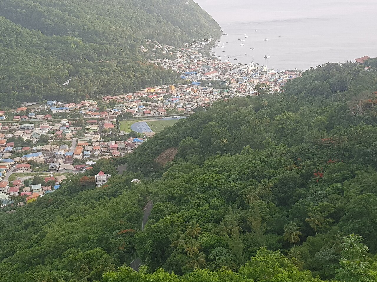
Things to do
Tet Paul Nature Trail: The Short Walk With the Big View
A community-run hill walk above Soufrière that rewards a modest climb with a wide view of the Pitons, the south coast and, on a clear day, two other islands.
What is the Tet Paul Nature Trail?
The Tet Paul Nature Trail is a short guided walk on a hill above Soufrière in southwest Saint Lucia. It is run as a community project, takes roughly 45 minutes at an easy pace, and climbs a natural staircase to a summit with views of the Pitons, the south coast and, on clear days, Martinique and Saint Vincent.
Saint Lucia has plenty of demanding hikes, and this is not one of them. It is the walk you choose when you want a proper view, a bit of botany and a sense of how people in the Soufrière area have farmed and lived, without committing a whole day or a pair of serious boots. The tourism authority lists it as an easy to moderate hike, and that matches what visitors describe. If you only have time for one walk in the south, this is the one that asks least and gives most. It leaves your legs fresh for the rest of the day, which matters in Saint Lucia's heat, and it suits people who dislike strenuous group hikes because the pace is unhurried and the guide does most of the talking.
The setting is one of the best on the island. The trail sits in the hills close to Soufrière, the island's first French capital, and the summit looks across a coastline that includes the two volcanic spires known as the Pitons.
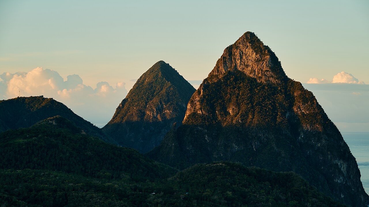
What can you see from the top?
The view is the reason most people come, and it is a wide one. From the high point you look along the southwest coast to the Pitons, across Jalousie Bay, and over the open sea. Tourism listings describe a panorama that takes in Morne Gimie, the island's highest mountain, the plains around Vieux Fort with its lighthouse, and the villages of Laborie and Soufrière below.
On a clear day the horizon adds two more islands. Martinique lies to the north and Saint Vincent to the south, both seen as low grey shapes on the water. Clarity depends on the weather and the time of day, so treat them as a bonus rather than a promise. Early in the day the air is usually at its clearest, and cloud tends to build around the high ground later. Photographers should plan around the light. Early sun gives the clearest air and the best colour on the coast, while the middle of the day can look flatter and hazier. A phone is perfectly good for the panorama, and a modest zoom helps if you want to pick out a boat or a distant headland. Take your time at the top, because the guide will usually let the group linger.
Even without the distant islands, the foreground does plenty of work. The hillsides are a patchwork of banana, fruit trees, forest and small plots, and you can see how steep the land is and why the volcanic peaks dominate everything. If you also plan to visit the south of the island, the Vieux Fort area comes into context when you can see it from above.
What will you learn about plants and farming?
The walk is guided, and the guide is half of the experience. Rather than striding to the summit, you stop often to look at what is growing beside the path. The trail begins at a working organic farm where fruit trees such as guava, avocado and soursop grow alongside herbs and bush plants that islanders have long used as remedies and flavourings.
Expect to be shown leaves to crush and smell, plants that are brewed as teas, and others that go into traditional treatments. Guides are usually happy to explain which uses are folk tradition and which are simply part of cooking. Treat all of it as cultural interest rather than medical advice. Our guide to local plants and traditional uses gives more background, and the wider story of the island's forests is told in rainforest and plant life.
Along the way you may see an old catchment pond that farming families in the Soufrière area once relied on, and a traditional house built to show how earlier generations lived, with its simple layout and local materials. Visitors also describe a cassava house, where the way cassava is produced is explained, with a picnic area close by. Exact stops can change, so ask your guide what is currently on show. Ask before you touch or taste anything, and do not pick plants for yourself. Some of what grows beside the path is safe to smell and some is not, and the guide knows the difference. Children often enjoy this part most, because there is always something to rub, sniff or guess at, and the stories behind the plants tend to stay in the memory longer than the names.
- An organic farm with fruit trees and medicinal plants at the start.
- A traditional house showing how early inhabitants lived.
- A cassava house and picnic area where the crop is explained.
- A catchment pond used by farming communities in the past.
How hard is the walk, and who is it for?
It is short, but it is not flat. The trail climbs a natural staircase of earth and stone, and some visitors know it by the nickname Stairway to Heaven. Steps can be uneven and, after rain, slippery. If you walk regularly, you will find it comfortable. If you do not, it is still manageable with a few pauses, and guides are used to setting a gentle pace.
It suits couples, families with children who are happy to walk, older travellers who want a view without a long hike, and anyone using a cruise stop or a short stay to see the south. It is less suitable for people who cannot manage steps or uneven ground, and we would not suggest it for pushchairs or wheelchairs. If you are unsure, speak to the operator before you book.
For a longer challenge, the island offers plenty. The climb of Gros Piton is a serious morning, and Mount Gimie is a long day. Tet Paul is the gentler alternative, and many people say it gives the best view for the least effort. Think of it as the opposite of a summit day. You will not need a dawn start, a long drive from a distant resort or a recovery afternoon, and you can fit it around breakfast and lunch without turning the day into a project.
How does it fit into a day around Soufrière?
The trail takes under an hour, so it pairs easily with other sights. A popular plan is to walk early, before the heat builds and while the air is clear, then head to the Sulphur Springs for the geothermal area and a mud bath, and finish with the waterfalls and gardens nearby.
If you want a longer, slower day, add a visit to a cocoa estate. The cocoa and chocolate guide explains the tours around Soufrière, and several include a walk through the plantation and a tasting. Lunch is easy to find in town or at a restaurant with a view, and our hiking and rainforest guide suggests gentler walks if you want to do more on foot.
Combining several stops needs a driver or a guide, since public transport on this stretch is limited and the roads are narrow and winding. Many visitors book a land tour from the north, though a day trip from Castries or Rodney Bay is long, so staying in the south makes the day far easier. If you do come from the north, set off early and agree a realistic return time with your driver, because the west coast road is slow and the light fades quickly in the evening.
Planning your visit
Book ahead where you can, and go with a guide, as the trail is walked with one. Entry arrangements, opening days and prices are set by the operator and can change, so check them directly before you go, and do not rely on a figure from an old listing. The tourism authority lists the trail under the Soufrière development foundation, and tour operators also sell it as a half day excursion.
Dry months make the path firmer and the views clearer, so the best time to visit guide is worth a look. Showers can arrive at any time of year, and the path is slippery when wet. Go in the morning if you can, because the sun is hot on the exposed upper section and the view is usually sharper.
Wear closed shoes with grip, not flip-flops. Bring water, sun protection, insect repellent and a hat, and carry a light rain layer, as our packing guide suggests. A camera helps, but keep a hand free on the steps. Because the trail is run as a community project, your visit supports local people, so carry a little cash for any refreshments or crafts offered and be generous with your thanks to the guide. If you are not hiring a car, our guide to getting around Saint Lucia explains the taxi and driver options.
Where to stay nearby
Staying in the south saves a long morning drive and lets you be at the trail early. The area around Soufrière has a good spread of places, from the cocoa estate setting of Rabot Hotel from Hotel Chocolat to the plantation grounds of Fond Doux Eco Resort and the hillside rooms and villas of Stonefield Villa Resort.
For a wider choice, browse all the hotels in Saint Lucia. If you are building a longer trip around the Pitons, the sister pages on the south coast will help you pick a base that suits your budget and pace.
Where to stay and how to plan
Most visitors fit this into holidays to St Lucia, so choose your base first. Compare St Lucia hotels by area and style, and read our guides to luxury hotels in St Lucia and all inclusive resorts in St Lucia if you are choosing between a boutique stay and an all in package.
Then set your dates with the best time to visit St Lucia, book flights to St Lucia and pick days out from our St Lucia itineraries. Couples can also read about a honeymoon in St Lucia or weddings in St Lucia.
Questions travellers ask
Where is the Tet Paul Nature Trail?
It is on a hill above the town of Soufrière in the southwest of Saint Lucia, a short drive from the town centre and the Pitons.
How long does the Tet Paul Nature Trail take?
Most visitors allow about 45 minutes for the walk itself at an easy pace, plus time at the start for introductions, plant stops and any refreshments.
Is the Tet Paul Nature Trail difficult?
It is listed as easy to moderate. The path climbs a natural staircase, so there are steps and uneven ground, but it is short and the pace is gentle.
Do you need a guide for the Tet Paul Nature Trail?
Yes, the trail is walked with a guide, who explains the plants, the farm and the traditional buildings along the way. Check arrangements with the operator before you go.
What can you see from the top of the trail?
You can see the Pitons, Jalousie Bay, the south coast and, on clear days, Martinique and Saint Vincent in the distance, depending on the weather.
What plants will you see on the Tet Paul Nature Trail?
Expect fruit trees such as guava, avocado and soursop, plus herbs and bush plants with traditional uses. Your guide will point out which ones locals use as teas or remedies.
Is the Tet Paul Nature Trail suitable for children?
Yes for children who enjoy walking and can manage steps. Hold hands on steep or slippery sections, and bring water and sun protection for them.
What should I wear for the trail?
Wear closed shoes with good grip, light clothing, a hat and sun cream, and carry water, insect repellent and a light rain layer in case of showers.
Can I visit the Tet Paul Nature Trail on a cruise day?
It is possible by taxi or excursion, but the south is a long drive from Castries, so allow generous time and book a driver who knows the route.
What else can I do near the Tet Paul Nature Trail?
Soufrière has the Sulphur Springs, waterfalls and gardens, cocoa estates, and views of the Pitons, so you can easily fill a full day around the trail.
Tet Paul Nature Trail on the map
Tet Paul Nature Trail is at 13.8200 degrees north, 61.0550 degrees west. Map data from OpenStreetMap contributors.
Ask Lucy about Tet Paul Nature Trail
Ask about places to stay, things to do, the weather or getting here.
Keep exploring Saint Lucia
Looking for the industry view? Visit St Lucia on VisitTravelGroup.com covers the destination for travellers and the tourism trade.
More from the Visit Travel Group network: VisitTravelGroup.com, Benidorm.co.uk, Anguilla.co.uk, TheRedSea.co.uk.